Wednesday, August 12, 2015

🚙2015 ~Tuesday, Aug 11, Milkey Way Manor, Giles County Tennessee

The day started with me getting my teeth cleaned at the dentist.
We ate breakfast around 10:30 A.M. at Cracker Barrel.
I ordered whole-wheat buttered toast, one scrambled egg, two slices of bacon, and unsweetened tea with lemon.
My husband ordered the Big Breakfast.
Our waitress said, I am running my butt off today because we are swamped.
Our next stop was in St Joseph, Tennessee, for lottery and scratch tickets.
I spent $5 on scratch-offs and won $7. 
Most of the time, I don't win anything.
We took Highway 64 into Pulaski for sightseeing.

 Giles County Historic Museum was our first stop, which was located in the Library. It was one huge room full of unforgettable, historic, notable, striking, and impressive items.
Giles County Historic Museum. 

A chair from the courthouse that was used (1857-1900) during the Civil

Giles County Historic Museum. 
In the one room museum, we saw a wall hanging quilt, Tennessee fifty-one Confederate Generals, Defending Elm Springs, picture of Rev Samuel Howell, a bookshelf full of old books, chair from the courthouse used (1857-1900) during the Civil, a wedding dress, several old school pictures, Medical books that belonged to Dr Louis A Edmundson, a picture of Walter Herschel Beech 1891-1950 builder of the Beechcraft Airplanes that we saw a few weeks ago in Tullahoma, Tin sign telling about Sam Davis, US Flag, Confederate Flag, & four wall hanging of Churches in Giles County.
Sitting in a corner was a case full of information about the Kentucky Derby, in which Mr. Mars played an important part.
I saw a picture of Gallahadion Winning the Kentucky Derby, owned by Mr. Mars from the Milky Way Farm Estate.
Gallahadion Winning the Kentucky Derby.
We saw the Thomas Martin House, now a bank.
CSB  Bank is located inside this beautiful old home, which is being repaired

Hubert & Grace Grissom Colonial Hall College
Our next stop was the Sam Davis Memorial Museum, the site of Sam Davis' hanging, located in the Sam Davis Avenue Historic District.
Sam Davis Avenue Historic District 
Tracing the original eastern city boundary and the Congressional Reservation Line, once dividing white and Indian territory, Sam Davis Avenue is named for a Confederate hero hanged by the Federals on this hill in 1863. The Historical District, placed on the National Register in 1989, contains outstanding architecture of the 1860~1910 period.
The Sam Davis Memorial Museum, where Sam Davis was hanged
Born October 6, 1842, near Smyra, Rutherford County, TN, though a Confederate Soldier in the line of duty, he was executed as a spy by the Federals at Pulaski, November 27, 1863
Had I a thousand lives to live 
Had I a thousand lives to give
I'd give them Nay
I'd gladly die
Before I'd live 
One Life a Lie 
Sam Davis's home, grave, and Museum are located in Smyrna, Tennessee. 
Sam Davis was buried near the family home, supposedly in a flowerbed, on Christmas Eve.
Coke Cola Building


PulaskiTN 38478 
Our next stop was the Milky Way Farms owned by Charles Jones and his daughter, Lynn Golden.
The home and farm are now used to host weddings, events, festivals, tours, guided hunting activities, and other seasonal activities.
Milky Way Farms Gates

Milky Way Farms
The farm began in 1931 when Frank Mars, the founder of the Mars Candy Company, purchased land in Tennessee. It was during a period of severe economic hardship in Giles County, and many people were losing their homes. Mr. Mars bought up the land, let the people stay in their homes, and had them work for him.
His farm employed hundreds of workers from the Giles County Area. Mr Mars had prized Herefords, the fastest horses, fine sheep, incredible barns, and a fantastic view for his house set atop a hill overlooking the valley below.

Milky Way Farms

Milky Way Farms Manor House 
The original dining room table measures 12' x 28' and can seat up to 40 people.
Fountain
  • In 1930-31, Frank Mars acquired 2,805 acres of land in Giles County.
  • In 1931, Frank Mars built the original home clubhouse, which burned down within a few months.
  • In 1931-32, Frank Mars rebuilt the Manor House as it stands today out of stone from his 2,800-acre estate (25,000 square feet, 20 bedrooms, 14 baths, and two ½ baths)
  • In 1931-34, a total of 30 barns, 70 cottages, a Mausoleum, and the world-famous "crooked sheep barn" were built.
  • In 1931-34, as many as 935 local hired hands were working for $.50 a day at Milky Way Farm.
  • In 1932, Frank Mars introduced the Three Musketeer candy bar
  • In 1932, Frank designed and built the Milky Way race track, where many champion thoroughbreds were trained including the 1940 Kentucky Derby Winner, Gallahadion
  • In 1931-34, Milky Way Farm was home to five nationally known livestock operations: Hereford cattle, thoroughbred horses, commercial dairy, beef cattle, and Hampshire sheep
  • The dining room table measures 12' x 28' and can seat up to 40 people.
We watched a five-minute video about the farm, we asked a few questions, and then we were told we could tour the whole house except the kitchen, where the curator was cooking.

The curator had a pot of green beans cooking in the kitchen for a large group arriving later that day. Boy, did they smell good! They have weddings & entertain large groups.
Staircase in Manor 

Staircase in Manor 

One of the twenty Bedrooms in the manor 

Fireplace in the Master Bedroom 

One of the twenty Bedrooms in the manor

Fireplace in the Living Room 

A lot of the farm has been sold, and most of the rest of it. The roads are not very good, so we did not venture any further.

We were going to try out the Bar BQ Restaurant between Athens and Rogersville, but it is not open on Mondays and Tuesdays. 
We picked up the van from Champion Chrysler after having the back seat fixed, so it will fit well in the storage and can be raised back into a sitting position.
We drove to Stanfield's in Rogersville, and my husband ordered a New York Strip, baked potato, and salad bar. I ordered the kids a three-piece shrimp plate with coleslaw and two hushpuppies.
Another hot day adventure, but most of what we did was inside. 
The clouds were beautiful today.

Monday, August 10, 2015

2009 ~Sunday Aug 23, Lawrence County Alabama Historical Markers

We started out in Courtland, taking pictures —first the Harris Simpson. Most of the other markers were in or near the city park.

This circa 1820 house is thought to be one of the oldest houses in Courtland. Occupying a lot platted by the Courtland Land Company in 1818, the house faces North toward what was once the main Tuscumbia Road. Dr. Jack Shackelford (1790-1857), an early settler and legislator, is believed to have lived in this house in the mid-1800s. After a nearby Civil War skirmish, the house served as a military hospital. In 1895, Mrs. Susan Jackson Harris, granddaughter of James Jackson of the famous Forks of Cypress Plantation near Florence and wife of John Hunter Harris of Rosemont Plantation, acquired the house. Her daughter, Caroline Harris Simpson, lived here until 19,72, and her descendants owned the house until 1995. In 2,001, the Alabama Preservation Alliance purchased and placed a protective easement on the property, which required all future owners to preserve the house and grounds.

This is a good example of the early American "I" house, so called for its tall, narrow side profile. The original part of the house is two stories, with two large rooms and a central hall on both floors. The braced-frame construction, a framing system that uses corner posts and bracing, is covered with beaded siding. Delicate Federal-period mantelpieces, molded trim, chair rails, and a paneled staircase grace the interior. Traces of faux~bois, a decorative painting technique popular in the 19th century, also survive. An unusual feature is the shed-roofed "chimney pent" (or closet) abutting the west chimney. Side and rear additions were added in the early 1900s.


The Town of Courtland 1819
Federal lands in this area were first sold in 1818 and quickly purchased by settlers and speculators. A group of investors calling themselves the "Courtland Land Company," consisting of William H. Whitaker, James M. Camp, William F. Broadnax, John M. Tifford, Benjamin Thomas, and Bernard McKiernan, acquired the future town site and had it laid out in a gridiron street pattern containing 300 lots. These were put up for sale immediately. In hopes that Courtland would become the county seat, the present square was set aside for a courthouse. Alabama's territorial legislature incorporated Courtland on December 13, 1819.

Major Lewis Dillahunty and his wife, Lucinda, reputedly settled at Courtland in 1816. Dillahunty, a surveyor, had fought with Andrew Jackson at New Orleans. Soon afterward, wealthy planters, with their families and slaves, arrived from Virginia, Tennessee, the Carolinas, and Georgia. They were joined by merchants, artisans, lawyers, doctors, preachers, and innkeepers as Courtland became the trade center for the surrounding farms and plantations. The Courtland Herald, a newspaper, was established in the 1820s. For most of its history, Courtland's population has ranged between 400 and 700.

Courtland's Early Architecture
Courtland's Early Architecture During the early 1800s, an assortment of wooden, brick, and log business structures surrounded the town square. Most of the old buildings on the square today (on the North and east sides) date from the late 1800s and early 1900s. The fronts of some of them feature characteristic Victorian detailing. At the northeast corner of the square are four 19th-century stone mounting blocks placed for the convenience of horseback riders. The tall red cedars seen throughout Courtland and along the streets radiating from the square have been a feature of the landscape since the early days. 

Courtland's Early Architecture 1820-1940
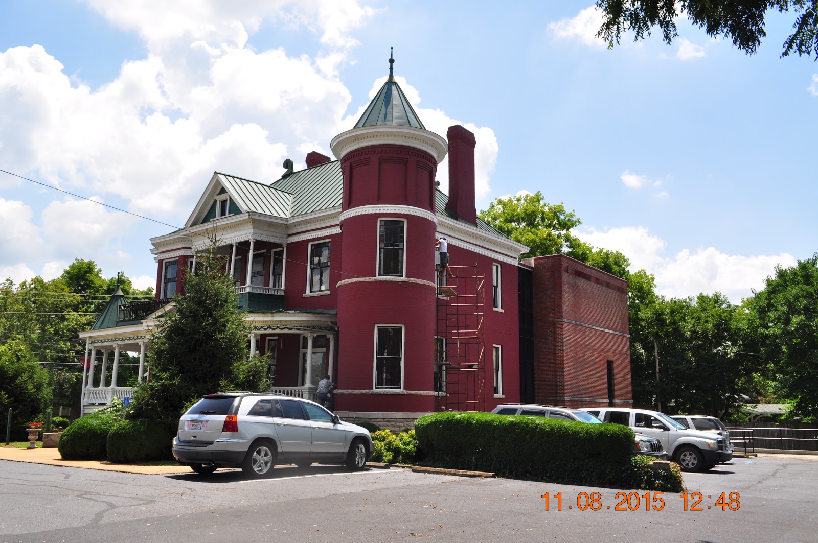
Courtland's Early Architecture: Structures within the Courtland historic district represent over 150 years of changing tastes in building design. Although only a few of Courtland's earliest buildings survive, the Federal-style architecture of the oldest houses suggests the community's strong original ties to Virginia and other upper South states. Typical early residences, whether frame or brick, feature a gable roof with tall chimneys at each end. Sometimes, weatherboarding conceals log walls underneath. Many buildings dating from the 1850s through the 1930s reflect Italianate, Victorian, and neoclassical architectural influences. There are also early 20th-century "bungalows", some built of native sandstone. Courtland still counts about twenty buildings predating the Civil War (1861). 


The African ~ American Experience
African Americans played a very significant role in the early history of Courtland. Most came as slaves from the older southern states to help clear the land, plant cotton and corn, and serve as household domestics. President Thomas Jefferson's great-grandson, William S. Bankhead, brought his personal servant and valet, Jupiter, from Monticello when he settled near Courtland in the 1840s. Skilled slave craftsmen also assisted in the construction of many Courtland buildings before the Civil War. After emancipation, most African Americans earned their livelihood as tenants and small farmers. 


The African ~ American Experience
Before being officially denied political participation by the state constitution of 1901, Courtland's African-American community produced the most successful local Republican party organization in North Alabama, on occasion uniting with area whites to create a biracial government. H. H. Stewart, a graduate of Williams College (Mass.), was an outstanding educational and political leader of the Courtland black community during this period. In the early 20th century, many Courtland-area African Americans migrated to the North and the Upper Midwest to seek greater economic and social opportunities.


The Red Rovers / Red Rovers Roster
A volunteer military company was organized at Courtland in 1835 to aid Texas in its struggle for independence. Commanded by Dr. Jack Shackelford, a local physician, the company derived its name from the color of the homespun uniforms made by citizens of Courtland. In the first battle, Rovers were assigned to the regiment cut off, captured at Coleta, March 20, 1836. Surrendered on promise of return to U. S. On March 27, company and others, 365 men, executed at Goliad by order of Gen. Santa Anna. Shackelford and seven other Rovers were spared. He later escaped and returned to Courtland. The Goliad incident, along with the Alamo, rallied U.S. support and guaranteed Texas's freedom.


The Red Rovers / Red Rovers Roster

* Capt. J. Shackelford • * Lt. Wm. C. Francis •Sgt. F. G. Shackelford • Sgt. A. J. Foley • * Sgt. J. D. Hamilton • Sgt. J. D. Hamilton • Sgt. C. M. Short • Cpl. J. H. Barkley • Cpl. H. H. Bentley • Cpl. David Moore • Cpl. Andrew Winter • Patrick H. Anderson • John N. Barnhill • Joseph Blackwell • * George W. Brooks • * L. M. Brooks • T. E. Burbridge • F. T. Burt • J. W. Cain • Thomas Cantwell • Seth Clark • John G. Coe • * D. Cooper • Harvey Cox • R. T. Davidson • George L. Davis • H. C. Day • A. Dickson • Alfred Dorsey • H. L. Douglas • W. C. Douglas • James E. Ellis • Samuel Farley • * Joseph Fenner • Robert Fenner • J. G. Ferguson • E. B. Franklin • D. Gamble M. C. Garner • J. E. Grimes • William Gunter • William Hemphill • John Hyser • John Jackson • John N. Jackson • H. W. Jones • Charles McKinley • John H. Miller • D. A. Murdock • William Quinn • W. F. Saavage • J. N. Seaton • W. S. Shackelford • * Wilson Simpson • B. Strunk • James Vaughan • Wm. E. Vaughan • James S. Wilder • Robert W. Wilson* Escaped at execution, on patrol, or on leave when the unit was captured.  

Early Roads
Tennessee Street along the north side of the square was originally part of Gaines' Trace, a horse path laid out in 1807 under the direction of Capt. Edmund Pendleton Gaines of the U. S. Army. From Melton's Bluff on the Tennessee River, the trace ran westward to Cotton Gin Port on the Tombigbee, in present-day Mississippi. Another crucial early thoroughfare was the Byler Road (1819), which ran southward through Courtland and linked the Tennessee Valley to Tuscaloosa and lower Alabama. 


One of the South's First Railroads, 1832
Seeking a means to ship cotton and other goods around the treacherous Muscle Shoals of the Tennessee River, area planters and merchants met at Courtland in 1831 to consider a rail line. On January 13, 1832, the 50-mile-long Tuscumbia, Courtland & Decatur railroad was chartered. Early trains were usually horse-drawn, although an English-made steam locomotive was acquired in 1834. Absorbed by the Memphis & Charleston line after 1850, the railway was largely destroyed during the Civil War. The rebuilt railroad became part of the Southern system in 1898.


American Legion - Post 58
On April 20, 1934, a temporary charter was issued for Gen. Joe Wheeler Post 58, Courtland, Alabama. On November 12, 1946, a permanent charter was granted, and the name was changed to Wiley Horton Post 58 in honor of the deceased son of State Department Commander C.C. Horton.

American Legion - Post 58
The American Legion is the largest veterans' organization in the United States. It seeks to advance the aims and interests of all veterans. The Legion has 16,000 local posts. Each year the American Legion sponsors over 3,000 baseball and other athletic teams, 3,600 Boy Scout Troops; also, national high school oratory contests to promote the study of the U.S. Constitution and the Bill of Rights.

2009 ~Aug 11-14 Meadow's Physical Therapy & McWane Center Birmingham, Al


Meadow at the RMH

Meadow is enjoying the water at the McWane Center.

Meadow is enjoying the water at the McWane Center.
Meadow at Dino dig at the McWane Center.
Meadow at Dino dig at the McWane Center.r
Meadow is enjoying the sand at the McWane Center.
Meadow is having physical therapy at Children's Outpatient Center PT & OT Hearing & Speech, located at 1208 3rd Avenue, Birmingham, from August 11-14.
On Tuesday, we rode to Birmingham and arrived just in time for Meadow's physical therapy at 9:00 A.M. 
We checked in at the RMH after MMeadow's appointment,
where we will be staying for the next few days. 
For lunch, we walked to Captain D's, which was just a block away.
Meadow loves to fish. 
We rode to the YMCA, where both Lora and I worked out. 
We put Meadow in Child Watch at the YMCA.
I rode the stationary bike for thirty minutes. 

Meadows' appointment on Wednesday is from 9:00–12:00 P.M.
We rode to the YMCA, after Meadows' physical therapy, where both Lora and I worked out. I rode the stationary bike for twenty-five minutes.
We put Meadow in Child Watch at the YMCA.
We rode to the mall to shop and stopped to get the tires checked on Lora's Car. 

On Thursday, Meadow had several different doctor appointments, one with Doctor Grant's cleft doctor, Nathaniel Robins's Genetic doctor, and an Otolaryngologist (ENT).
Meadow's therapy was from 3:00 to 6:00 P.M. 
We ate lunch at McDonald's. Meadow likes the chicken nuggets.
We squeezed in an hour at the McWane Center, where Meadow enjoyed playing in the sand & water.

Friday was Meadow's last day of physical therapy, which was from 9:00 to 11:00 P.M. 
Before we went to therapy, we cleaned our room, washed our clothes, and checked out of the RMH. 
After Meadow's therapy, we walked several blocks, pushing Meadow in her wheelchair, to the Fish Market, where we ate lunch. 

Lora and I split a Traditional Greek Salad with Crisp romaine and iceberg lettuce, ripe tomatoes, Salonica peppers, and green olives topped with feta cheese and Greek dressing. 

Lora and I  split a Bam Bam Group.
Fried lightly, then tossed with a sweet-and-spicy sauce. Served with Greek Roasted Potatoes.

After we finished our meal, we walked back to the car and rode home. We were home by 4:30.

Sunday, August 9, 2015

🚗 2009 ~Sunday Aug 9, Fort Payne Historic Markers, Alabama Museum, Ruby Falls

We started the day by eating breakfast at Steak & Shake in Huntsville. We were on our way to Fort Payne when we stopped along the road to take pictures of Historic sites and markers.

Alabama's Music Fan Club & Museum, which houses memorable items once owned by Randy Owens, Teddy Gentry, Jeff Cook, and Mark Herndon
Crow Town in Stevenson
One of the Five Lower Towns was established by the Chickamauga Cherokees in 1782 under Dragging Canoe's leadership. Territorial Governor William Blount reported to the Secretary of War in 1792 that: "Crow Town lies on the north side of the Tennessee (River), half a mile from the river, up Crow Creek, 30 miles below the Suck. (It) is the lowest town in the Cherokee Nation and contained 30 huts in 1790. The Creeks and Northward tribes cross (the river) here." 
All of the Five Lower Towns were on the extreme Cherokee frontier. Running Water and Nickajack were near Chattanooga, Tennessee. Long Island Town was twenty miles below the Suck, east of Bridgeport, Alabama. Lookout Mountain Town was near Trenton, Georgia.
(Continued on another side)


Crow Town in Stevenson
Crow Town encompassed several miles by the early 1800s as increasing numbers of Cherokee families settled there. With the creation of Jackson County in 1819, many Cherokees moved to the south side of the river – some 19th-century maps placed Crow Town near the southeast end of Snodgrass Bridge, which carries Highway 117 across the Tennessee River east of Stevenson. The 1782 site of Crow Town, one-half mile from the confluence of Crow Creek and the original channel of the Tennessee River, was flooded with the closing of the spillway gates at Guntersville Dam in 1939.
Trail of Tears Bridgeport
In May 1838, soldiers, under the command of U.S. Army General Winfield Scott, began rounding up Cherokee Indians in this area who had refused to move to Indian Territory in Oklahoma. About 16,000 Cherokees were placed in stockades in Tennessee and Alabama until their removal. Roughly 3,000 were sent by boat down the Tennessee River, and the rest were marched overland in the fall and winter of 1838-1839. This forced removal under harsh conditions resulted in the deaths of about 4,000 Cherokees.
In late June of 1838, a party of 1,070 poorly equipped Indians was marched overland from Ross' Landing at Chattanooga, Tennessee, to Waterloo, Alabama, because of low water in the upper Tennessee River. Following the general route of present-day U.S. Highway 72, they camped at Bellefonte, where about 300 escaped between Bellefonte and Woodville. On June 26, the remainder refused to proceed. Consequently, the militia, under the command of Army Captain G.S. Drane, was tasked with mobilizing the group and escorting them to Waterloo. Arriving in miserable condition on July 10, 1838, the Cherokee were placed on a boat to continue their journey West.
The "Trail of Tears," which resulted from the Indian Removal Act passed by the U.S. Congress in 1830, is one of the darkest chapters in American history.


Alabama Welcomes You, the 22nd State
Alabama's Fan Club and Museum, Randy Owens and Teddy Wayne Gentry
Alabama's Fan Club and Museum Mark Joel Herndon & Jeffrey Alan Cook
Alabama's Fan Club and Museum 
Fort Payne City Park


At Fort Payne City Park, we saw several historical markers and the individual statues of Teddy Wayne Gentry, Jeffery Alan Cook, Randy Yeuell Owen, and Mark Joel Herndon, all members of the group Alabama.

Fort Payne's Fort
The fort, consisting of a log house and an enormous stockade, was built in 1838 by order of General Winfield Scott, commander of military forces responsible for the removal of Cherokee Indians.
Soldiers occupying the fort were commanded by Captain John C. Payne, for whom the fort was named.
Indians in the DeKalb County area who refused to move westward voluntarily were gathered and held in the stockade pending their forceful removal to the Indian territory.

Willis Town Mission
The mission was established in 1823 by the American Board of Commissioners for Foreign Missions to promote education and Christianity among the Cherokee. The mission operated until the Indian removal in 1838. 
Gravesite of Reverend Ard Hoyt, the first superintendent, marks the location of the mission near the corner of 38th Street and Godfrey Avenue.
Sequoyah 1760-1843
Born in Tennessee, Sequoyah moved to the Wills Town (DeKalb County, Alabama) area of the Cherokee Nation in 1818.
Here, in 1821, he invented an 86-symbol alphabet providing the Cherokees with the only written Indian language in the United States.
(Sequoyah, Maker of the Cherokee Alphabet)


Confederate War Marker
Fort Payne's Train Museum.
The Fort Payne Depot Museum was erected in 1891. 
It is housed in a unique Richardsonian Romanesque building of locally quarried pink and white sandstone. It served as a depot for the Alabama-Great Southern Railroad for approximately 85 years. The Gussie Killian Collection, housed in the north room, contains extensive examples of Native American basketry, pottery, and artifacts. Our south room displays the L.A. Dobbs exhibit, along with memorabilia from the Civil War, World War I and II, and the Vietnam War. 


Boom Town Historic District
Around 1889-1891, Fort Payne experienced a major industrial boom, driven by New England investors who speculated heavily on the area's mineral deposits. During this period, several highly ornate commercial and civic buildings, along with the planned park, were constructed along Gault Avenue. The Fort Payne Opera House and other buildings in the same block been built by the Fort Payne Coal & Iron Co., together with the Sawyer Building, the Alabama Great Southern Railroad Depot & Union Park, which retain the integrity of the boomtown era and comprise a historic district listed in the National Register of Historic Places in 1989, the year of Fort Payne's centennial.

Fort Payne Train Museum.
Lookout Mountain Ruby Falls

Inside Ruby Falls, we saw Potato Chip.

Ruby Falls


Inside Ruby Fal, we saw Steak and Potatoes.
Lookout Mountain Ruby Falls

Relaxing after the long trip into the cave
My trip to Ruby Falls


My trip to Ruby Falls
Our last stop, Oga at Ruby Faons in Lookout Mountain. 
We watched a movie, went down an elevator, and then were taken on a guided tour through the caverns to a thundering underground waterfall. 
Cost $18.95 each 


Lookout Mountain Welcome to Ruby Falls

Lookout Mountain
The Chattanooga area was firmly under the control of the Chickamauga Indians at the time of the American Revolution. The Cherokee Indian chiefs had signed peace and land treaties with the Colonial settlers. However, a small group of rebellious Cherokees were not in accord with these treaties and continued unabated warfare with the expanding settlers. They were called the Chickamaugas and were led by Chief Dragging Canoe. They were actively supported by the British through local agents and traders. The Government of North Carolina authorized a Military Campaign against them in the summer of 1782, pledging Support from the Continental Congress. Colonel John Sevier organized a force of some 250 "Nolichucky Riflemen" to pursue the Chickamauga and rescue captives. On September 20, 1782, after several minor encounters, Sevier and his men engaged the Chickamaugas in a battle high in the Palisades at the north end of Lookout Mountain. The Frontiersmen's accurate rifle fire soon overcame their foes. This was an official Revolutionary War engagement and is considered by many to be the LAST "VER-MOUNTAIN" BATTLE OF THE AMERICAN REVOLUTION.
The preliminary signing of the peace treaty ending the Revolution was on November 30, 1782.

Lookout Mountain 
We rode to Fort Payne, Alabama, to visit the Group Alabama Museum, the Train Depot Museum, and the city park to see the statues of Teddy Wayne Gentry, Jeffery Alan Cook, Randy Yeuell Owen, and Mark Joel Herndon of the Group Alabama.

The historic markers I took pictures of were: Payne's Fort, Battle of Wauhatchie, Boom Town, Crown Town in Stevenson, Decatur County, Fort Payne City Park, Sequoyah Marker, The Trail of Tears at Bridgeport, and Willis Town Marker.

We ate lunch at Cracker Barrel in South Pittsburg, rode over to Chattanooga, and went down into the cave to see Ruby Falls. 
Ruby Falls is an underground waterfall that is 145 feet high and has been named one of the most Incredible Cave Waterfalls on Earth.
It is America's deepest commercial cave and largest underground waterfall.

We went down an elevator shaft to the cave's floor, where we were given a tour. We talked about the rock formations, and the grand finale was the colorful Ruby Falls, a small hole where water was coming out.
Some of the rock formations that we saw were Totem Pole, Crystal Chandelier, Donkey Formation, 
tobacco leaves, elephant's foot, Steak and Potatoes, Potato Chips, Leaning Tower, Dragon's foot, Beehives, Angle's Wings, Niagara Falls, Weight Watchers Lane, and Leo's passage.
Another great day of sightseeing!

Footprints in the Sand and other Poems by famous authors

  One night, a man had a dream. He dreamed he was walking along the beach with the Lord. Across the sky, scenes from his life flashed. For...